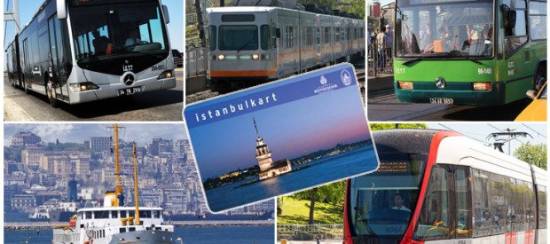
Guide to Transportation and Getting Around inside Istanbul
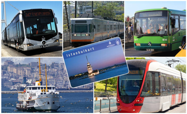
Public transport systems and the convenient Istanbul Kart for getting on all of them
Public transport in Istanbul has been revolutionized in the last decade with new networks and extensions from Metro to Tram, making the city easier than ever to get around.
For visitors trying to explore the most famous sights of Istanbul, you’ll mostly be using the public transport system by Tram, Metro, Funicular and Tünel for cheap, efficient and fast travel.
As the majority of sightseeing is on the European side, this guide will focus on land transport for tourists getting to and from those including local tips, useful stops and real examples of using multiple transport connections.
The public transport discussed on this page are:
- Tickets & Payment
- Which transport to use?
- Most Useful Public Transport for Tourists:
- Tram: T1: Kabataş-Bağcılar
- Funicular (Underground): F1: Taksim-Kabataş and F2: Tünel
- Metro (Underground): M2: Yenikapı-Hacıosman
- Bus: IETT and Metrobus
- Real Life Examples with Multiple Connections
- Map of Public Transport Links
- Resources & Credits
Tickets & Payment:
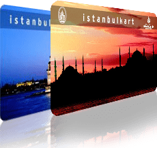
The IstanbulKart is the easiest way of using public transport in Istanbul
Instead of cash, you’ll need to buy a pre-paid travel pass (Istanbul Kart) or token (Jeton), available from most street kiosks or automated machines just inside the entrance of underground stations:
(1) Best Choice – ‘IstanbulKart’ (or ‘Akbil’):
This anonymous top-up card is cheap to buy (10 TL), works on all public transport types, benefits from discounted rates and can be used by more than one person.
Buy it at the start of your trip, load it with some credit (we suggest loading 10-20 TL to start), swipe it at the turnstiles to get through, then top-it-up again later if needed.
Highly recommended to all visitors planning to use public transport, even for short stays.
(2) ‘Jeton’:
Buy this pre-paid token resembling a plastic coin and deposit it at ticketing turnstiles to get through. It is more expensive, has no discounts and can’t be used on different transport types – advisable for rare or single use only.
Which Transport To Use?
Do as locals do and opt for metro, tram and funicular or boat whenever possible, rather than slow-moving buses and taxis.
This way you can get as close as possible to your destination first, and only use a bus/taxi for the last section of the journey if necessary, saving time and avoiding unnecessary delays and jams in Istanbul’s ferocious traffic, particularly at peak times.
We also suggest Smartphone Apps such as ‘Moovit’ or ‘BuradanOraya’ which offer route planners in English for connecting multiple forms of public transport.
Let’s take a closer look at these options:
Most Useful Transport for Tourists:
T1: Kabataş-Bağcılar Tram
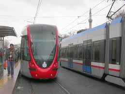
T1 Tram in Istanbul
This is a tourist-friendly and convenient line taking you past or nearby to most of the major touristic sights between the Old City and New City via the Galata Bridge across the Golden Horn.
This is mostly an over-ground ‘Light Rail’ or ‘Tramway’ system with modern air-conditioned or heated carriages to take you comfortably throughout the summer and winter.
This is a fast way to travel. As the tram uses a dedicated tram-only lane, it bypasses all road traffic, unlike some other countries.
Upcoming stops are announced in Turkish and English, shown on the LED displays and route map over the door, so it’s clear at all times where you are and where you’re going.
Local Tips for T1 Tram
- Is sometimes signposted as the ‘Light Rail’, which may be confusing, but know that this means the Tram.
- It can get very crowded at peak times, but if at first you can’t get on, at most you’ll only need to wait 2 minutes more until the next one.
- If you’re the only person to get on/off, you may need to push the button on the door to open it.
Operating Information for T1 Tram:
- First Train: 06:00
- Last Train: 23:50
- Frequency: every 5 minutes, or every 2 minutes at peak times
- Ticket Payment: IstanbulKart or jeton (pre-paid token).
Useful Stops for Tourists on T1 Tram:
| Tram Stop | Nearby Sights Of Touristic Interest |
|---|---|
| Kabataş | Dolmabahçe Palace, Mosque & Tea Gardens by the waterfront, Hekimoğlu Paşa Fountain Connect here for: Funicular F1 to Taksim Square, Ferries and sea buses to Asian side and Princes’ Islands, bus hub |
| Fındıklı | Rainbow Stairs, Molla Çelebi Mosque, a small waterfront park by the Bosphorus, uphill walk to neighborhood of Cihangir. |
| Tophane | Istanbul Modern (Art Gallery), Tophane Fountain, Kiliç Ali Paşa Hamam, water pipe (nargile) street, cruise ship docks |
| Karaköy | Karaköy trendy cafe area, cruise ship port, Galata Bridge, famous Gulluoglu Baklava. Connect here for: Tünel (funicular) to Beyoğlu, Ferry Port. |
| Eminönü | Galata Bridge, Spice Market, Yeni Cami (New Mosque), Ferry Piers, Golden Horn. Connect here for: Bosphorus ferries and piers for Princes’ Islands and Asian Side. |
| Sirkeci | Sirkeci Train Station, many camera accessory shops |
| Gülhane | Gülhane Park, Archaeological Museum, Çağlaoğlu Hamam |
| Sultanahmet | Haghia Sophia, Underground Basilica Cistern, Blue Mosque, Topkapi Palace, Hippodrome, Turk & Islamic Arts Museum, Mosaic Museum, Haseki Hurrem Sultan Hamam, Firuz Aga Mosque |
| Çemberlitaş | Grand Bazaar, Çemberlitaş Hamam, Şerefiye Cistern, Çorlulu Ali Paşa mosque and medrese complex with nargile cafes |
| Beyazıt | Grand Bazaar, Süleymaniye Mosque, ornate gate of Istanbul University, Sultan II Beyazıt Mosque, Sahaflar Bazaar |
| Topkapı | Old City Walls (Byzantine city walls and Cannon Gate). Connect here for: Metro M2 line. |
F1: Taksim-Kabataş Funicular
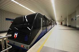
F1 funicular in Istanbul
This is a one-stop line climbing the steep hill between Kabataş and Taksim Square, connecting metro (M2) with the tram (T1) via an underground tunnel.
It uses a spacious and modern set of air-conditioned/heated rail carriages and runs every 5 minutes up and down the hill with the ride itself lasting only 2½ minutes. Despites escalators and elevators for access most of the way, some walking and steps are required.
Both stops at either end of this one-stop line are a common route for tourists for how to get between Sultanahmet and Taksim – this line is the missing link. Simply take the tram from Sultanahmet to Kabataş, then change to the F1 from Kabataş to Taksim, or vice versa. Duration is approx. 20-25 minutes in total.
Local Tips for F1 Funicular in Istanbul:
- An overhead LED signboard shortly before the turnstile area indicates the minutes remain until next departure.
- At the Kabataş end, an easy underground walkway links it directly with the Tramway, much safer than attempting to cross the busy highway above.
- At the Taksim end, a short walkway and escalator links it to the Taksim Square exit. A flight of stairs are required for the last floor to reach the exit to Taksim Square, unless you look for the elevator around the corner.
Operating Information for F1 Funicular:
- First Train: 06:15; 06:30 on Sundays
- Last Train: 00:50; 01:20 on Fridays and Saturdays
- Frequency: every 5 minutes
- Duration: 2.5 minutes
- Ticket Payment: IstanbulKart or jeton (pre-paid token).
Useful Stops for Tourists on F1 Funicular Istanbul:
| Tram Stop | Nearby Sights Of Touristic Interest |
|---|---|
| Kabataş | Dolmabahçe Palace, Mosque & Tea Gardens by the waterfront, Hekimoğlu Paşa Fountain Connect here for: T1 Tram to Sultanahmet, Ferries and sea buses to Asian side and Princes’ Islands, bus hub |
| Taksim | North Istiklal Street, Taksim Square, neighborhoods of Taksim, Beyoğlu, Cihangir and Harbiye. Connect here for: M2 metro line and underground bus hub. |
F2: Tünel Funicular
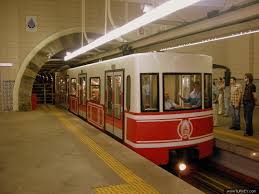
F2 – Tünel in Istanbul
Built in 1875, this is 2nd oldest urban underground rail system in the world (after the London Underground). This single-stop line climbs a 1km steep hill between Karaköy/Galata and Tünel Square on lower Istiklal Street in Taksim via an underground tunnel.
The line provides a connection to the tram (T1) at Karaköy stop at the bottom of the hill and with the metro (M2) at Şişhane stop at the top of the hill and to Taksim’s Istiklal Street, a 1 km walk to Taksim Square for those who prefer to walk.
It runs every 5 minutes up and down the hill with the ride itself lasting only a few minutes.
Local Tips for F2 Tünel:
- The carriage is set slightly at a slope as it travels the hill so hold onto the bars if standing.
- The entrance at the Karaköy end can be difficult to spot – look for the small sign above it’s entrance though a building near the tram line.
- Enjoy an interesting walk up Istiklal Street to the top of Taksim Square, to see the downtown cosmopolitan cultural center of various shops, restaurants and nightlife.
Operating Information for F2 Tünel:
- First Train: 07:00; 07:30 on Sundays
- Last Train: 22:45 everyday
- Frequency: every 5 minutes
- Duration: 1½ minutes
- Ticket Payment: IstanbulKart or jeton (pre-paid token).
Useful Stops for Tourists on F2 Tünel:
| Tram Stop | Nearby Sights Of Touristic Interest |
|---|---|
| Karaköy | Karaköy trendy cafe area, cruise ship port, Galata Bridge, famous Güllüoğlu Baklava shop, Karaköy fish market. Connect here for: T1 Tram and Karaköy Ferry Port. |
| Tünel Square, Taksim-Beyoğlu | Galata Tower, Whirling Dervish Lodge, Lower Istiklal Street, Asmali Mescit & Nevizade restaurant streets Connect here for: M2 Metro. |
M2: Yenikapı-Hacıosman Metro
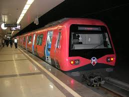
M2 Metro in Istanbul
This is the most convenient way to get close to further-away suburbs, shopping malls and beautiful villages along the Bosphorus for a nice seaside walk.
This is the Green Line rapid transit underground train similar to the Underground in New York or the Tube in London. Started in 1992, this line is an essential line linking many of Istanbul’s leafier Bosphorus suburbs, popular shopping centers, financial, commercial, cultural and nightlife areas to the city center. Many new stops have opened in the last year as it is expanded across the new Golden Horn Metro Bridge joining Old City peninsula with the New City.
It’s a spacious modern and comfortable method of transport. It runs every 3-5 minutes at peak times with only FEW minutes ride in between stops.
Being underground metro, a number of escalators and elevators provide access down to the platform to minimize walking, however some steps are usually still required at some platforms.
Local Tips for M2 Metro:
- Most metro stations have clean and well-maintained modern bathroom facilities located close to the entrance, in advance of the ticketing turnstiles. So they can be used without intention to board a train. A small fee is charged for the service – simply swipe your IstanbulKart or a pre-paid token (jeton) at the door to enter.
- Don’t be surprised by queue skippers, and people boarding the train before letting others off, a daily reality of life in Istanbul!
- Do as locals do to avoid traffic – Take a metro, tram or boat to get as close to your destination as possible to optimize your time, then connect the last section with taxi or bus if needed.
Operating Information for M2 Metro:
- First Train: 06:15; 06:30 on Sundays
- Last Train: 00:50; 01:20 on Fridays and Saturdays
- Frequency: every 5 minutes
- Ticket Payment: IstanbulKart or jeton (pre-paid token).
Useful Stops for Tourists on M2 Metro:
| Metro Stations | Nearby Sights Of Touristic Interest |
|---|---|
| Yenikapı | Kumkapi fish market and restaurants |
| Vezneciler | Istanbul University, Beyazıt Square, Şehzade Mosque |
| Haliç (Golden Horn) | Suleymaniye Mosque, Fener and Balat neighborhoods |
| Şişhane | Galata Tower, Tunel (upper entrance), South Istiklal Street, neighborhoods of Taksim, Galata, Karaköy |
| Taksim | North Istiklal Street, Taksim Square, Asmali Mescit & Nevizade Streets, neighborhoods of Taksim, Beyoğlu, Cihangir and Harbiye |
| Osmanbey | military museum, Harbiye convention congress center, open air theater, concert hall, Macka Park, neighborhoods of Nişantaşi, Kurtulus, Ferikoy and Harbiye |
| Şişli—Mecidiyeköy | Cevahir (via underground passageway) and Profilo shopping centers, Ortakoy (few mins drive away), neighborhoods of Nisantasi, Kurtulus, Ferikoy and Harbiye |
| Gayrettepe | Astoria and Zorlu Shopping Malls |
| Levent | Kanyon Shopping Mall (via underground passageway), Akmerkez Shopping Center (few mins walk away), Rumeli Fortress, Arnavutkoy and Kurucesme waterfront neighborhoods (few mins drive away) |
| 4. Levent | Istanbul Sapphire (tallest building in turkey), Bebek (few mins drive away) |
| İ.T.Ü.—Ayazağa | Istinye Park Shopping Mall, Emirgan Park, Sakip Sabanci Museum, Yenikoy and Baltalimani waterfront neighborhoods (all 5-10 mins away by taxi) Maslak financial district, Istinye Port, ITU Technical University |
| Hacıosman | Southern Sarıyer and Tarabya neighborhoods |
IETT: Local Public Bus
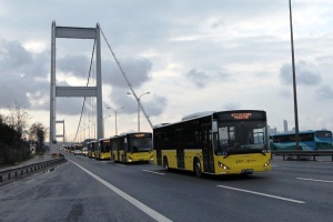
IETT public buses in Istanbul
Istanbul’s public bus system is run by IETT with the European side’s main hub in Kabataş. Carrying over 1 million passengers a day, newer buses have yellow and black livery, older ones in green, blue or red and blue.
To see what destinations the buses passes through, check the signboard next the main passenger entrances on the sides of the bus.
Crossing the bridge to the Asian side, or taking a bus after midnight costs twice the standard ticket fare.
The bus is most convenient for short hops, or routes not covered by metro, tram, boat and funicular, as you may get stuck in traffic jams at peak times.
It’s easy to use and identify which bus and stops to get on at by using some of the online tools and transport apps, such as:
IETT Route Planner & Mobile App:
To make things easy, please try the IETT online Route Planner here or download the IETT mobile app to identify which bus you’ll need on which route.
- Choose English language for it to work when you enter place names with or without Turkish characters, for example ‘Kabatas’ or ‘Kabataş’ (notice the s) will both work.
- Enter your desired ‘From’ and ‘To’ destinations, for example, from Kabatas to Ortakoy.
- Optional – If you want to plan a route for a future time or date, you can choose this option by clicking the clock icon also. If you don’t choose it, it defaults to now and the next available bus.
- Click the ‘Plan My Journey’ button.
- The screen will change to show one or more suggested bus routes – click on these for more details and a map of the route to make your choice.
Useful IETT Bus Routes for Tourists
- For visiting Dolmabahçe Sarayi: To visit Dolmabahce Palace, look for a bus with destination of Besiktaş from Sultanahmet, Eminonu or Taksim. Press the stop button to get off at the next stop when you see the palace on your left.
- For visiting European side of the Bosphorus: Look for buses with destination of Sariyer and be sure check it is taking the coast road – check the signboard on the side of the bus shows some of these places: Ortaköy, Arnavutköy, Bebek, Rumeli Hisari, Emirgan and Tarabya on the side of the bus.
- For visiting Eyup: Look for buses departing from Eminonu. On board look out for the city walls on the left hand side, then Eyup is the next stop.
Local Tips:
- Jeton tokens can be purchased in little IETT kiosks near bus stops and do not work on other forms of transport. Not all bus stops may have jeton kiosks nearby so plan in advance. It’s always easier to have your Istanbul Kart.
- There are no buses operating in Sultanahmet anymore, so for this area please use the tram and metro.
- As well as the IETT buses, there is a private bus system (Özel Halk Otobüsü) in turquoise and blue livery, which you can also use for similar prices.
Operating Information:
- First Train: usually 6:00
- Last Train: usually 00:00 midnight, except for a few 24 hour buses.
- Frequency: depends on timetable.
- Ticket Payment: IstanbulKart or jeton (pre-paid token).
MetroBus
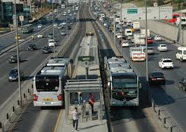
Metrobus in Istanbul on dedicated lanes
Using a dedicated metro bus only lane, these rapid buses connect Europe and Asian sides on a single fixed line.
While fast method of getting to many locations, this is not one of the most user-friendly transport systems, particularly for first-time visitors so tram and metro are recommended where available first.
The approaching stop is announced in Turkish and appears on a media screen so you can follow where you are.
Local Tips:
- During peak hours, metrobuses are usually overcrowded, platform signposting is poor, queues are long and access passageways congested, so if you’re a first time tourist, we recommend choosing metro/tram/boat combinations when available first.
Real Life Examples with Multiple Connections:
For common destinations requiring multiple transport hops, here’s some examples of how to get from A to B:
| From: | To: | How To Get There: |
|---|---|---|
| Sultanahmet | Taksim | Take the T1 tram from Sultanahmet to Kabataş, F1 funicular up to Taksim and you’ll exit at Taksim Square. |
| Taksim | Istanbul Modern | Take the F1 funicular to Kabatas, take the T1 tram to Tophane stop. |
| Taksim | Grand Bazaar | Take the F1 funicular to Kabatas, take the T1 tram to Beyazit or Cemberlitas stop. |
| Sultanahmet | Cevahir Shopping Center | Take the T1 tram from Sultanahmet to Kabataş, F1 funicular to Taksim, M2 metro to Mecideyekoy and there is an underground passageway connecting directly to the shopping mall. |
| Taksim | Harbiye Conference Center | Take the M2 metro to Osmanbey, take the Pangalti exit and walk there within 5-10 minutes. |
| Bakirkoy | Cevahir Shopping Center | Take the T1 tram from Bakırkoy to Kabataş, F1 funicular to Taksim, M2 metro to Mecideyekoy and there is an underground passageway connecting directly to the shopping mall. |
| Levent | Sultanahmet | Take the M2 metro to Taksim, F1 funicular to Kabatas, T1 tram to Sultanahmet. |
| Sultanahmet | Dolmabahce Palace | Take the T1 tram from Sultanahmet to Kabataş and it’s 5-10 minutes walk away. |
| Galata Bridge/Karaköy | Nişantaşı | Take the Tünel funicular to Taksim, walk 5 minutes to Şişhane metro stop to enter the M2, take this line to Osmanbey and it’s 5-10 minutes walk to Nişantaşı. |
| Taksim | Suada Club, Kuruçeşme or Arnavutköy | Take the M2 metro to Levent then finish the journey with a 10-15 minutes taxi drive to the waterfront. |
| Taksim | Kabataş Pier | Take the F1 funicular down to Kabataş. |
| Kabataş | Ortaköy | One option of many – Take the 30D IETT Bus from Kabataş stop to Galatasaray University stop, get off and walk 5 minutes to Ortaköy (suggested by the IETT Route Planner App) |
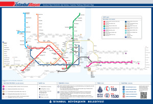
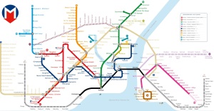
Map of Istanbul Public Transport Systems
Please click the Istanbul transportation maps with below to view them enlarged:
Resources & Credits
https://www.metro.istanbul/en/YolcuHizmetleri/AgHaritalari
https://metrobus.iett.istanbul/en/
https://en.wikipedia.org/wiki/Istanbul_Metro
Suggested Transport Apps: Moovit, Buradan Oraya (From Here To There), IETT Route Planner (bus only)
Photo Credits: HowToIstanbul, IETT


Leave a Comment